MAP OF WORCESTER COUNTY MASSACHUSETTS.
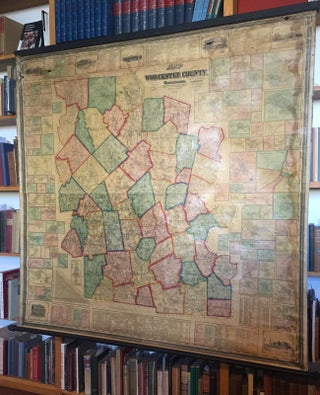
[MAP- WORCESTER COUNTY]. MAP OF WORCESTER COUNTY MASSACHUSETTS. Based upon the trigonometrical Survey of the State. The Details from Actual Surveys under the Direction of Henry F. Walling. Boston & New York: Wm. Baker & Co., 1857. 63"x 62". A large format wall map of Worcester County, Massachusetts surrounded by..... More