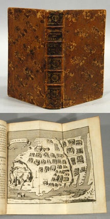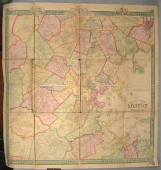
MAP OF THE CITY AND VICINITY OF BOSTON MASSACHUSETTS
1852. VERY LARGE, SCARCE MAP OF 1852 BOSTON SIDNEY, F. G. [i.e. J. C.] MAP OF THE CITY AND VICINITY OF BOSTON MASSACHUSETTS. [Philadelphia: R. P. Smith for] Boston: J. B. Shields, 1852. First Edition. A full color folding map, 40 3/4" x 41 1/2", comprised of 24 linen-backed panels..... More